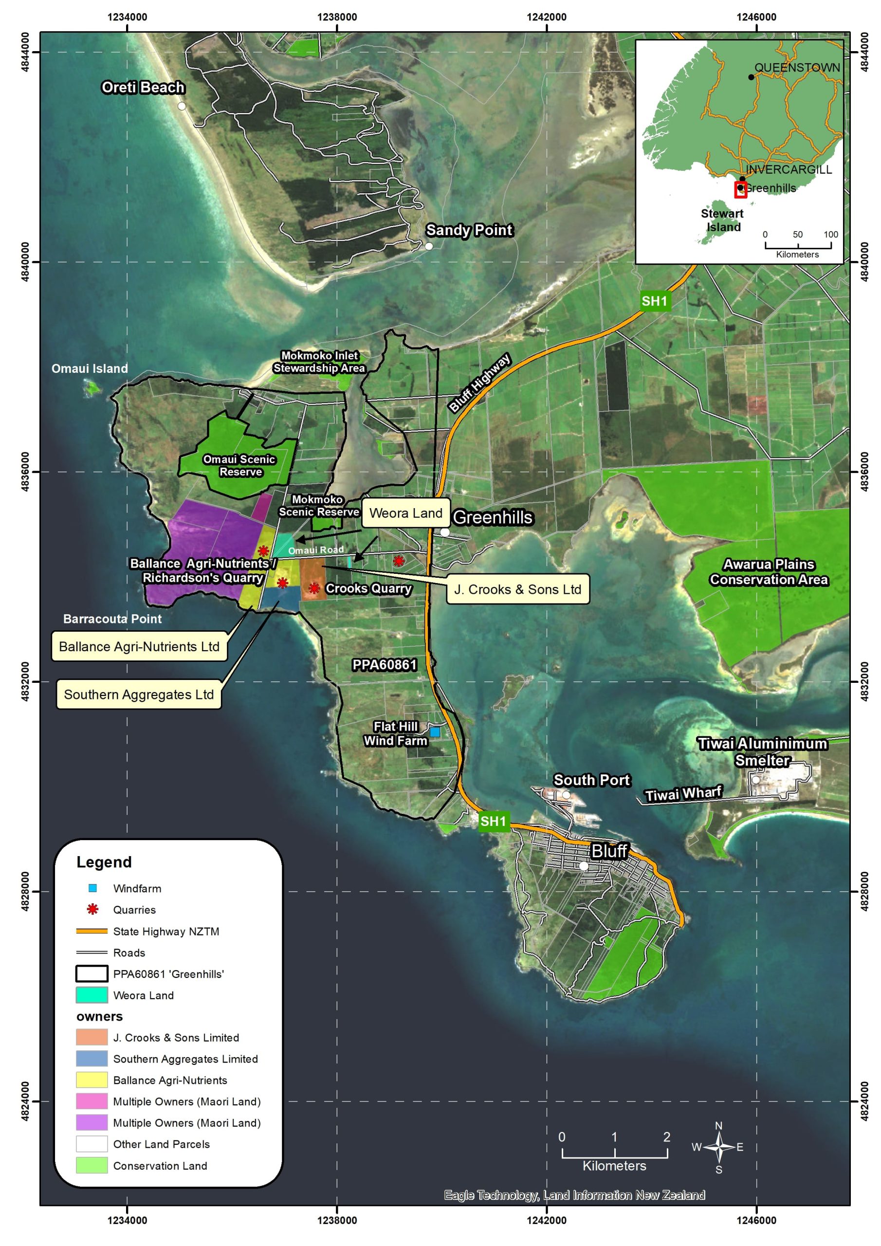
PP60861 Greenhills
- The Greenhills permit is located on farmland on the southern coast of Southland.
- Four deep drill holes have been completed at Greenhills for rock sample testing.
- The Greenhills permit area is close to the port at Bluff as well as significant CO2 emitters such as the Tiwai Point Aluminium Smelter, fertiliser production, forestry, and milk factories.
- The port at Bluff is in the ideal location to be the Southern Hemisphere major CO2 receiving and storage hub.
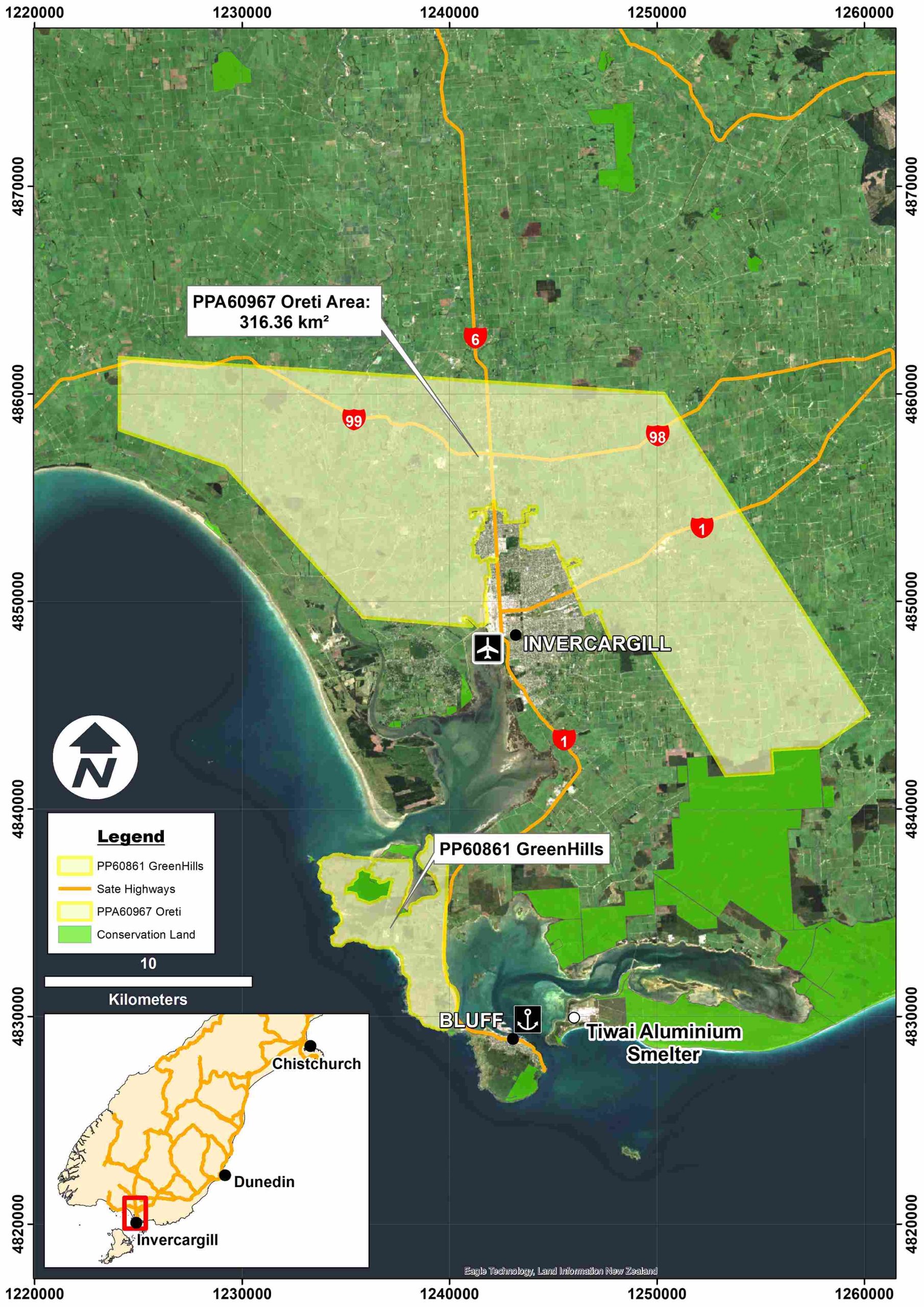
PPA60967 Oreti
- Oreti is centred on the Southland plains surrounding Invercargill city.
- Oreti contains a large magnetic and gravity anomaly thought to represent a large buried mafic igneous intrusion associated with the Brook Street terrane.
- We are investigating the potential for in situ CO2 mineralisation within the application area.
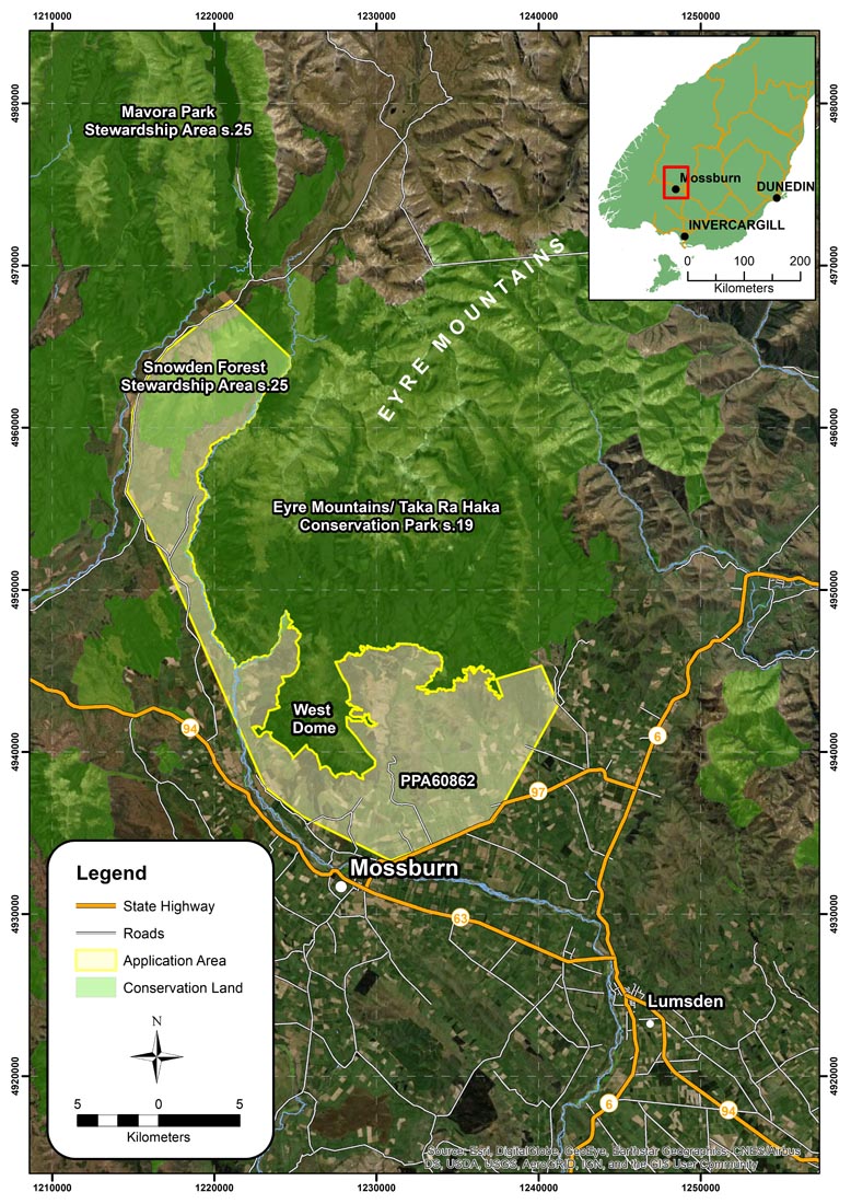
PP60862 West Dome
- West Dome is located close to the township of Mossburn, in northwest Southland.
- Previous exploration in the West Dome area has been primarily focused the Platinum Group Elements (PGE’s).
- Large, mapped Serpentinite bodies are the initial targets for study.
PPA60969 Red Hills
- Red Hills Is located southeast of Nelson in the Richmond Range
- The 290 km2 application is centred on the largest mass of dunite and other ultramafic rocks in New Zealand.
- Previous modelling suggests that the ultramafic rocks extend to over 5 km below the surface.
- The ultramafic rocks of Red Hills are well known and contain on average 45-50% MgO. Experimental work has already completed on the rock’s capability for CO2
- Weora understands the natural character and recreational values associated with the Reds Hills. As such, Weora will only investigate possibility of in situ mineralisation which causes less surface disturbance than ex situ mineralisation.
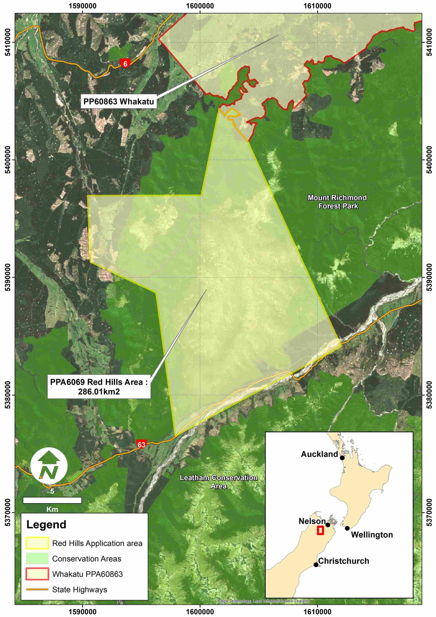
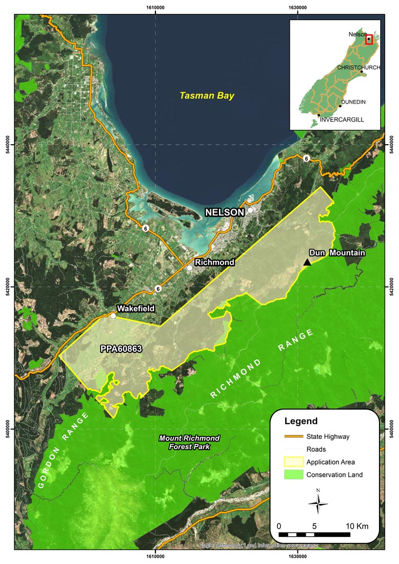
PP60863 Whakatu
- Whakatu is situated on the Western slopes of the Richmond Range, Tasman Region, east of the city of Nelson.
- Above and below ground mapped dunite and harzburgite bodies are the initial targets.
- Nelson district is renowned for its forestry, fishing and other processing industries, all of which are CO2.
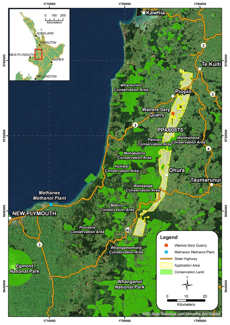
PP60875 King Country
-
- King Country is situated on farmland in South Waikato – King Country, North Island.
- Buried ultramafic ophiolites of the Dun Mountain Terrane underlie the Permit area.
- Previous exploration activity in the area has centred on oil and gas exploration with 10 petroleum wells drilled in the application area.
- Methanex’s Methanol Plant at Motunui is approximately 50 km to the east of the King Country Permit area. Methanex burns ~45% of Aotearoa NZ’s natural gas output and is a large emitter of CO2.
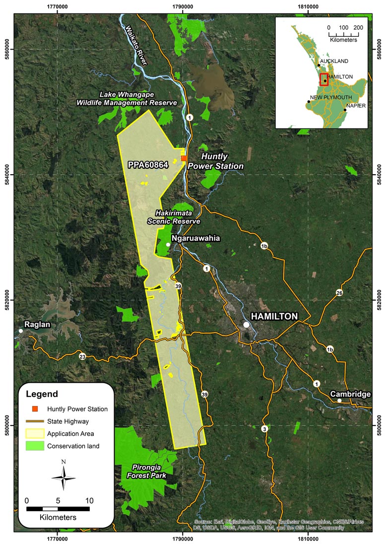
PP60864 Waikato
- Waikato is situated on the rolling farmland of North Waikato.
- Buried ultramafic ophiolites of the Dun Mountain Terrane underlie the Permit area. Associated magnetic anomalies from the 2007 Sinosteel aeromagnetic survey within the application area are the initial targets for exploration.
- Previous exploration activity in the area has centred on coal exploration.
- Huntly Power Station lies adjacent to the NE boundary of the Waikato permit. This Power Station is one of the country’s largest emitters of CO2.
- Immediately to the north lies NZ Steel’s Glenbrook operation and many other heavy carbon-emitting industries.
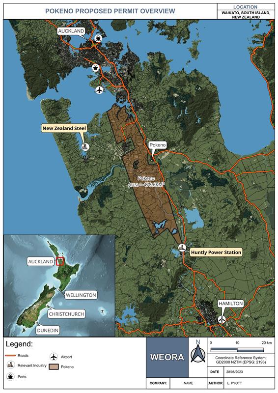
PPA61051 Pokeno
- The Pokeno permit is located on the boarder of the Waikato and Auckland regions, just north of Weora’s Waikato permit.
- The permit overlies an area of buried Ultramafic ophiolites from the Dun Mountain Terrane. The exploration target areas are based off magnetic anomalies.
- Previous exploration has been centred around coal exploration, however, Weora believes that this area could be prospective for carbon mineralization due to both the geology and its proximity to some of New Zealand’s Major emitters.
- The significant emitters near the permit area include New Zealand Steel and the Huntly Power Station.